GIS Versioning vs. Audit Trails: Can You Prove Yesterday's Service Boundary?
A practical guide for utilities, municipalities, and infrastructure teams that need to recover historical geometry, explain the decision context around it, and export reviewable evidence without replacing their operational GIS.
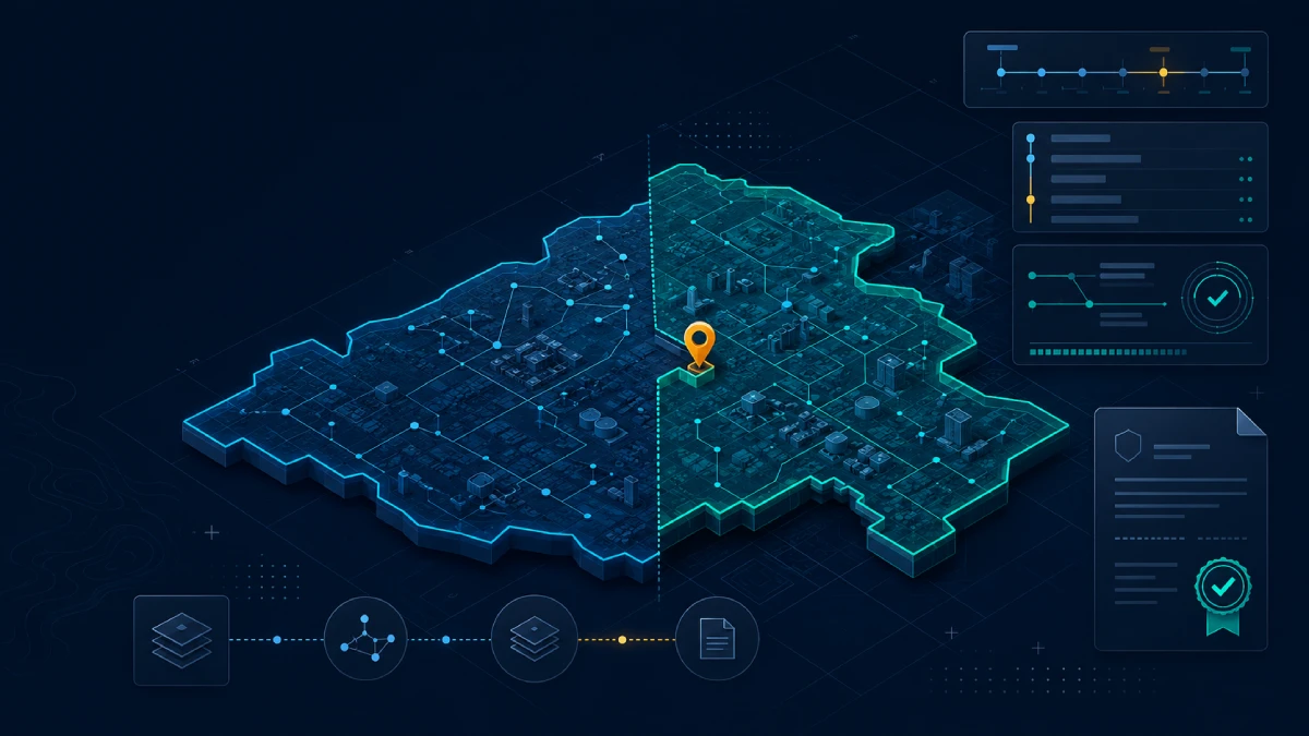
A versioned service boundary becomes useful evidence when geometry, approval context, and query history remain connected.
Pilot scopeOne boundary layer
Core questionWhat was valid then?
Evidence unitVersion + query + receipt
Deployment postureBeside existing GIS
Introduction
The map can be correct today and still fail to explain yesterday
Imagine a utility answering a service-eligibility request on March 12 at 09:00. At that moment, the customer address falls inside Service Zone A. Three months later, a boundary correction moves the address outside the zone. When a complaint arrives in July, the operational map correctly shows the new boundary—but that is not the boundary the team relied on in March.
The important question is no longer “Where is the boundary now?” It is “Which accepted boundary was effective when the decision was made, who approved it, what geometry did the query use, and can another reviewer reproduce the result?” A current map alone cannot answer that chain of questions.
This is the practical difference between spatial data versioning and an audit-ready GIS evidence workflow. A version history may let an internal specialist recover an earlier feature. A complete GIS audit trail connects that geometry to dataset identity, approval context, query conditions, integrity checks, and a portable review package.
The operational risk is not only an incorrect map. It is a decision that was reasonable at the time but can no longer be proved.
The accountability gap behind historical service-boundary disputes
Current industry approach
What standard GIS versioning already does well
Established GIS platforms already solve important parts of this problem. ArcGIS editor tracking can record who created or edited a feature and when. Geodatabase archiving can preserve historical changes and support access to a historical moment. Branch versioning supports controlled multiuser editing and review workflows. QGIS, PostGIS, and custom data platforms can provide similar foundations through temporal tables, transaction history, triggers, or application logs.
Those capabilities matter, and a proof layer should not pretend otherwise. Operational GIS remains the right place for editing, cartography, field synchronization, topology, routing, geocoding, and other mature geospatial work.
The gap appears when evidence must cross system and organizational boundaries. The geometry may live in a geodatabase, the approval reason in a ticket, the customer decision in a CRM, and the exported map in a shared folder. Each item may be available, yet the relationship among them is fragile.
Accountability problem
Version history is not automatically portable, audit-ready evidence
A historical feature is necessary, but it is only one part of a defensible record. Reviewers often need to know whether the feature was a draft or an accepted state, when it became effective, why it changed, and whether a past query actually used that version.
The distinction becomes clearer when the two outcomes are compared directly. GIS versioning focuses on preserving and managing state. A spatial audit trail packages the state with the context required to review a specific decision.
Review question
Typical version history
Audit-ready spatial evidence
Who edited the feature and when?
Often available
Included with the reviewed version
Can the previous geometry be recovered?
Usually, when history is retained
Included or referenced by an immutable version identifier
Was this the accepted and effective state?
May require another workflow
Approval and effective-time context stay attached
Why did the boundary change?
Often stored in a ticket or note
Reason and source reference travel with the event
Which geometry answered the original query?
May need manual reconstruction
Query context is bound to the version used
Can an external reviewer inspect it?
Often requires GIS/database access
A bounded receipt and export package can be shared
Evidence model
Six groups of information make a historical boundary reviewable
A practical evidence model does not need to copy an entire enterprise system into a blockchain GIS application. It needs a deliberately bounded record that preserves the identity and integrity of the spatial state while leaving sensitive operational material in the system that owns it.
1. Dataset identity
A stable dataset ID, layer purpose, owner, coordinate reference system, and policy boundary.
2. Feature and version identity
A stable feature ID, monotonically traceable version, parent relationship, and status such as proposed, accepted, or superseded.
3. Time and approval context
Recorded time, effective time, actor or role, change reason, and a reference to the approval source.
4. Geometry integrity
The geometry or a bounded representation, geometry type, envelope, validation result, and checksum.
5. Query and proof context
The point, bounding box, or predicate used, the dataset version queried, the result, and the time of verification.
6. Portable evidence
A proof receipt, manifest, audit excerpt, version history, and integrity values that another reviewer can inspect.
Worked example
A service boundary through two accepted states
A clean timeline allows a reviewer to separate editing time from effective time and to reconstruct the exact state used by a past decision.
January 15 — Version 1 acceptedService Zone A is approved and becomes the effective operational boundary.
March 12 — Eligibility query recordedThe customer point is evaluated against Version 1 and returns inside the service area.
June 2 — Correction proposedA geometry adjustment is submitted with a source reference and review reason.
June 20 — Version 2 acceptedThe corrected boundary becomes effective; Version 1 remains available as a superseded state.
July 4 — Complaint reviewedThe reviewer retrieves Version 1, the March query context, and the receipt that connects the decision to that geometry.
TermiNode approach
Put the proof layer beside the operational GIS
The least disruptive architecture keeps day-to-day GIS work where it already happens. Editors maintain the authoritative layer in ArcGIS, QGIS, PostGIS, or another operational system. A controlled publication step sends an accepted spatial state and its bounded governance context to TermiNode. TermiNode preserves version relationships, audit events, checksums, bounded query results, and exportable proof receipts.
This creates a simple flow: operational GIS, validation and approval, TermiNode proof layer, then buyer or reviewer verification. The source system remains responsible for rich editing and private records; the proof layer becomes responsible for verifiable spatial state and reproducible evidence.
TermiNode runs on the Internet Computer, while evaluation begins with the evidence workflow rather than the underlying blockchain. A historical GIS boundary can be identified, queried, checked for integrity, and reviewed without granting broad database access.
Keep editing in the current GISPreserve established data stewardship, field, topology, and cartographic workflows.
Publish an accepted stateValidate a bounded Polygon or MultiPolygon payload and attach its status, reason, and source reference.
Preserve the audit relationshipConnect dataset, feature, version, actor, time, checksum, and supersession events.
Query a named versionEvaluate a point or bounded area against the exact spatial state relevant to the decision.
Export evidenceShare a receipt and bounded record set that a reviewer can inspect independently.
Proof receipt
What a receipt can establish—and what it cannot
A useful proof receipt identifies the dataset, feature, version, query, result, time, and integrity values involved in a verification. It gives reviewers a stable handle for comparing an exported record with the spatial state held by the proof layer.
A receipt does not make the source data correct, approve a business decision, prove regulatory compliance, or guarantee legal admissibility. Those conclusions still depend on governance, source quality, jurisdiction, retention controls, and human review. The receipt strengthens traceability; it does not replace accountability.
Real-world start
Begin with one layer and one proof question
A first pilot should be deliberately small. Choose one public or synthetic boundary layer, ideally three to five Polygon or MultiPolygon features in EPSG:4326. Define one question such as “Which approved service boundary contained this address on March 12?” Then perform one controlled version change and ask someone outside the implementation team to review the exported evidence.
This scope is enough to expose the hard parts: identity, effective time, approval context, version-bound queries, privacy boundaries, export format, and reviewer usability. It also avoids turning a proof-of-value exercise into a full GIS migration.
The strongest early users are utility and municipal GIS managers, enterprise GIS architects, infrastructure and asset teams, data-governance or internal-audit owners, and integrators who must connect evidence across systems.
Layer1 public or synthetic
Geometry3–5 polygons
Change1 controlled version
Review1 independent reviewer
Buyer checklist
Questions to ask before calling a GIS workflow auditable
The following questions turn a broad governance claim into a reviewable acceptance test.
Can the system distinguish proposed, accepted, effective, and superseded spatial states?
Can a reviewer recover the geometry that was effective at a named time?
Are change reason, responsible role, and source reference attached to the version event?
Can a point or bounded spatial query be executed against a named historical version?
Can a reviewer inspect the evidence without receiving full operational database access?
Does the export include a manifest, version history, relevant audit events, and integrity values?
Are private documents, personal data, media, and credentials kept outside the public proof layer?
Can the workflow integrate beside the existing GIS rather than forcing a platform replacement?
Are retention, recovery, controller, and monitoring responsibilities explicit?
Can the buyer reproduce the result with its own sample and reviewer?
Conclusion
Maps show what is true now; accountable workflows explain what was accepted then
Historical service-boundary disputes are rarely solved by displaying the latest layer more clearly. They are solved by preserving the exact spatial state, its decision context, and the query that relied on it.
Standard GIS versioning remains an essential foundation. A GIS proof layer extends that foundation when organizations need portable evidence, bounded external review, and stronger geospatial verification across system boundaries.
If your team has one boundary layer and one decision it must be able to explain months later, that is enough to test the model.
No. It is a GIS proof layer for versioned spatial state, audit events, bounded queries, and exportable evidence beside an operational GIS.
How is a GIS audit trail different from editor tracking?
Editor tracking records who edited a feature and when. An audit-ready trail also connects the accepted version, effective time, reason, query context, integrity values, and portable evidence.
What data should stay outside the proof layer?
Personal data, secrets, private documents, photographs, credentials, and other sensitive operational records should remain in their controlled source systems.
Can a pilot begin with GeoJSON?
Yes. A small EPSG:4326 Polygon or MultiPolygon layer is a practical first input, subject to validation and an agreed public or synthetic data boundary.
Is a proof receipt automatically legal evidence?
No. It improves traceability and integrity review but does not guarantee source correctness, compliance, approval, or legal admissibility.
Who should own the workflow?
The spatial dataset owner should work with the governance, audit, compliance, or operational owner responsible for the decision the geometry supports.