See what changed
Each accepted feature update creates another version instead of silently replacing the previous geometry.
terminode.xyz
Keep the GIS and field tools your team already uses. TermiNode gives selected boundaries, zones, corridors, and event footprints a version history, audit trail, proof context, and portable evidence package.
The missing record
When a boundary changes, the earlier state, approval context, and related evidence can end up scattered across files and systems. TermiNode keeps the accepted spatial record readable after the map has moved on.
Each accepted feature update creates another version instead of silently replacing the previous geometry.
Dataset, bounding-box, viewport, and paginated reads keep reviews scoped and predictable.
Proof receipts and checksum-backed exports can be archived, handed over, or reviewed outside the DApp.
Available now
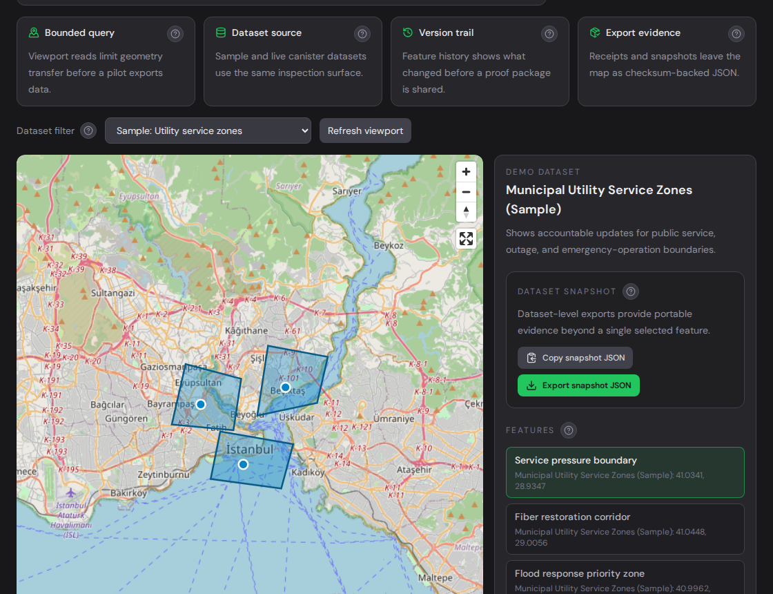
The live DApp is open for technical evaluation. Start with the sample layer, follow one feature through its audit context, and export the resulting evidence.
Query bounded geometry, select a feature, review its proof context, and export dataset or feature evidence.
Validate GeoJSON or WKB, estimate write usage, and follow Candid, TypeScript, REST/OGC, QGIS/ETL, and revision-safe sync recipes.
MCP clients can inspect datasets, versions, audit events, snapshots, partner references, and service metrics without write authority.
Where it fits
TermiNode is not intended to replace ArcGIS, QGIS, Mapbox, routing, basemap, search, or field software. It sits beside those systems when a selected spatial state must remain explainable later.
Connect inspections, handovers, media references, or approvals to the zone, corridor, or asset boundary they concern.
Compare versions, inspect audit-safe metadata, and verify the same portable evidence package another team received.
Use canister APIs and controlled adapters to add spatial accountability to an existing product or data pipeline.
FAQ
A verifiable spatial evidence layer on the Internet Computer. It versions selected GIS records and exposes audit, proof, query, and export workflows.
One public-safe boundary, corridor, zone, or event footprint with a clear review question and a team responsible for accepting the result.
No. TRMG is limited to product utility accounting for write and proof workflows and governance support. Trading, custody, fiat, and operator-run markets are outside the public MVP.